module file / cartesianC More...
Data Types | |
| type | axisattinfo |
Functions/Subroutines | |
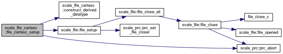
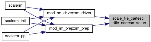
| subroutine, public | file_cartesc_setup |
| Setup. More... | |
| subroutine, public | file_cartesc_cleanup |
| deallocate buffers More... | |
| subroutine | file_cartesc_get_size_id (fid, KMAX, OKMAX, LKMAX, UKMAX, IMAXG, JMAXG, KHALO, IHALO, JHALO) |
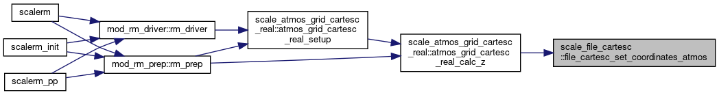
| subroutine, public | file_cartesc_set_coordinates_atmos (CZ, FZ, LON, LONUY, LONXV, LONUV, LAT, LATUY, LATXV, LATUV, TOPO, LSMASK) |
| set latlon and z for atmosphere More... | |
| subroutine, public | file_cartesc_set_areavol_atmos (AREA, AREAZUY_X, AREAZXV_Y, AREAWUY_X, AREAWXV_Y, AREAUY, AREAZXY_X, AREAZUV_Y, AREAXV, AREAZUV_X, AREAZXY_Y, VOL, VOLWXY, VOLZUY, VOLZXV) |
| set area and volume More... | |
| subroutine, public | file_cartesc_set_coordinates_ocean (VOL) |
| set volume for ocean More... | |
| subroutine, public | file_cartesc_set_coordinates_land (VOL) |
| set volume for land More... | |
| subroutine, public | file_cartesc_set_coordinates_urban (VOL) |
| set volume for urban More... | |
| subroutine, public | file_cartesc_open (basename, fid, aggregate) |
| open a netCDF file for read More... | |
| subroutine, public | file_cartesc_create (basename, title, datatype, fid, date, subsec, haszcoord, append, aggregate, single) |
| Create/open a netCDF file. More... | |
| subroutine, public | file_cartesc_enddef (fid) |
| Exit netCDF file define mode. More... | |
| subroutine, public | file_cartesc_flush (fid) |
| Flush all pending requests to a netCDF file (PnetCDF only) More... | |
| subroutine, public | file_cartesc_close (fid) |
| Close a netCDF file. More... | |
| subroutine | file_cartesc_read_1d (basename, varname, dim_type, var, step, aggregate, allow_missing) |
| interface FILE_CARTESC_read Read data from file This routine is a wrapper of the lower primitive routines More... | |
| subroutine | file_cartesc_read_var_2d (fid, varname, dim_type, var, step, allow_missing) |
| Read 2D data from file. More... | |
| subroutine | file_cartesc_read_var_3d (fid, varname, dim_type, var, step, allow_missing) |
| Read 3D data from file. More... | |
| subroutine | file_cartesc_read_var_4d (fid, varname, dim_type, step, var, allow_missing) |
| Read 4D data from file. More... | |
| subroutine | file_cartesc_read_auto_2d (fid, varname, var, step, existed) |
| Read 2D data from file. More... | |
| subroutine | file_cartesc_read_auto_3d (fid, varname, var, step, existed) |
| Read 3D data from file. More... | |
| subroutine | file_cartesc_write_1d (var, basename, title, varname, desc, unit, dim_type, datatype, date, subsec, append, aggregate, standard_name, cell_measures) |
| interface FILE_CARTESC_write Write data to file This routine is a wrapper of the lowere primitive routines More... | |
| subroutine, public | file_cartesc_put_globalattributes (fid, prc_rank_x, prc_rank_y, prc_num_x, prc_num_y, prc_periodic_x, prc_periodic_y, kmax, okmax, lkmax, ukmax, imaxg, jmaxg, khalo, ihalo, jhalo, time, tunits, calendar) |
| put global attributes More... | |
| subroutine | file_cartesc_def_axes (fid, dtype, hasZ) |
| define axis variables in the file More... | |
| subroutine | file_cartesc_write_axes (fid, haszcoord, start) |
| write axis to the file More... | |
| subroutine, public | file_cartesc_def_var (fid, varname, desc, unit, dim_type, datatype, vid, standard_name, timeintv, nsteps, cell_measures) |
| Define a variable to file. More... | |
| subroutine | file_cartesc_write_var_1d (fid, vid, var, varname, dim_type) |
| Write 1D data to file. More... | |
| subroutine | file_cartesc_write_var_2d (fid, vid, var, varname, dim_type, fill_halo) |
| Write 2D data to file. More... | |
| subroutine | file_cartesc_write_var_3d (fid, vid, var, varname, dim_type, fill_halo) |
| Write 3D data to file. More... | |
| subroutine | file_cartesc_write_var_3d_t (fid, vid, var, varname, dim_type, timeintv, timetarg, timeofs, fill_halo) |
| Write 3D data with time dimension to file. More... | |
| subroutine | file_cartesc_write_var_4d (fid, vid, var, varname, dim_type, timeintv, timetarg, timeofs, fill_halo) |
| Write 4D data to file. More... | |
| subroutine | set_dimension_informations |
| subroutine | set_dimension (name, ndims, dims, size, mapping, area, area_x, area_y, volume, location, grid) |
| subroutine | construct_derived_datatype |
| construct MPI derived datatypes for read buffers More... | |
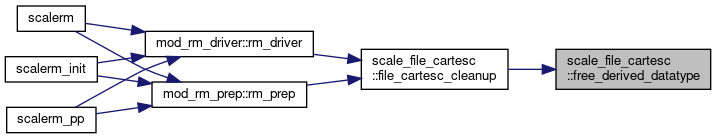
| subroutine | free_derived_datatype |
| free MPI derived datatypes More... | |
Detailed Description
module file / cartesianC
- Description
- file I/O handling for the cartesianC grid
- History Output
- No history output
Function/Subroutine Documentation
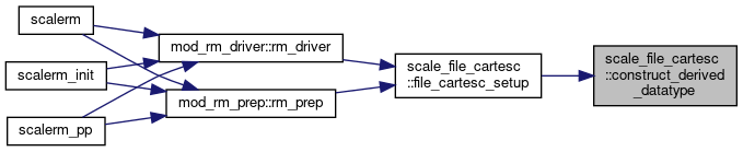
◆ file_cartesc_setup()
| subroutine, public scale_file_cartesc::file_cartesc_setup |
Setup.
Definition at line 209 of file scale_file_cartesC.F90.
References construct_derived_datatype(), scale_file::file_setup(), scale_io::h_institute, scale_io::h_source, scale_atmos_grid_cartesc_index::ia, scale_atmos_grid_cartesc_index::ie, scale_io::io_fid_conf, scale_atmos_grid_cartesc_index::is, scale_atmos_grid_cartesc_index::ja, scale_atmos_grid_cartesc_index::je, scale_atmos_grid_cartesc_index::js, scale_atmos_grid_cartesc_index::kmax, scale_land_grid_cartesc_index::lkmax, scale_ocean_grid_cartesc_index::okmax, scale_prc_cartesc::prc_2drank, scale_prc::prc_abort(), scale_prc::prc_myrank, scale_prc_cartesc::prc_num_x, scale_prc_cartesc::prc_num_y, scale_precision::rp, and scale_urban_grid_cartesc_index::ukmax.
Referenced by mod_rm_driver::rm_driver(), and mod_rm_prep::rm_prep().
◆ file_cartesc_cleanup()
| subroutine, public scale_file_cartesc::file_cartesc_cleanup |
deallocate buffers
Definition at line 314 of file scale_file_cartesC.F90.
References file_cartesc_get_size_id(), scale_file::file_open(), free_derived_datatype(), scale_atmos_grid_cartesc_index::ihalo, scale_atmos_grid_cartesc_index::imaxg, scale_atmos_grid_cartesc_index::jhalo, scale_atmos_grid_cartesc_index::jmaxg, scale_atmos_grid_cartesc_index::khalo, scale_atmos_grid_cartesc_index::kmax, scale_land_grid_cartesc_index::lkmax, scale_ocean_grid_cartesc_index::okmax, and scale_urban_grid_cartesc_index::ukmax.
Referenced by mod_rm_driver::rm_driver(), and mod_rm_prep::rm_prep().


◆ file_cartesc_get_size_id()
| subroutine scale_file_cartesc::file_cartesc_get_size_id | ( | integer, intent(in) | fid, |
| integer, intent(out) | KMAX, | ||
| integer, intent(out) | OKMAX, | ||
| integer, intent(out) | LKMAX, | ||
| integer, intent(out) | UKMAX, | ||
| integer, intent(out) | IMAXG, | ||
| integer, intent(out) | JMAXG, | ||
| integer, intent(out) | KHALO, | ||
| integer, intent(out) | IHALO, | ||
| integer, intent(out) | JHALO | ||
| ) |
Definition at line 399 of file scale_file_cartesC.F90.
Referenced by file_cartesc_cleanup().

◆ file_cartesc_set_coordinates_atmos()
| subroutine, public scale_file_cartesc::file_cartesc_set_coordinates_atmos | ( | real(rp), dimension( ka,ia,ja), intent(in) | CZ, |
| real(rp), dimension(0:ka,ia,ja), intent(in) | FZ, | ||
| real(rp), dimension ( ia, ja), intent(in) | LON, | ||
| real(rp), dimension(0:ia, ja), intent(in) | LONUY, | ||
| real(rp), dimension( ia,0:ja), intent(in) | LONXV, | ||
| real(rp), dimension(0:ia,0:ja), intent(in) | LONUV, | ||
| real(rp), dimension ( ia, ja), intent(in) | LAT, | ||
| real(rp), dimension(0:ia, ja), intent(in) | LATUY, | ||
| real(rp), dimension( ia,0:ja), intent(in) | LATXV, | ||
| real(rp), dimension(0:ia,0:ja), intent(in) | LATUV, | ||
| real(rp), dimension ( ia, ja), intent(in) | TOPO, | ||
| real(rp), dimension( ia, ja), intent(in) | LSMASK | ||
| ) |
set latlon and z for atmosphere
Definition at line 454 of file scale_file_cartesC.F90.
References scale_const::const_d2r, scale_atmos_grid_cartesc_index::ke, and scale_atmos_grid_cartesc_index::ks.
Referenced by scale_atmos_grid_cartesc_real::atmos_grid_cartesc_real_calc_z().
◆ file_cartesc_set_areavol_atmos()
| subroutine, public scale_file_cartesc::file_cartesc_set_areavol_atmos | ( | real(rp), dimension ( ia,ja), intent(in) | AREA, |
| real(rp), dimension( ka,ia,ja), intent(in) | AREAZUY_X, | ||
| real(rp), dimension( ka,ia,ja), intent(in) | AREAZXV_Y, | ||
| real(rp), dimension(0:ka,ia,ja), intent(in) | AREAWUY_X, | ||
| real(rp), dimension(0:ka,ia,ja), intent(in) | AREAWXV_Y, | ||
| real(rp), dimension ( ia,ja), intent(in) | AREAUY, | ||
| real(rp), dimension( ka,ia,ja), intent(in) | AREAZXY_X, | ||
| real(rp), dimension( ka,ia,ja), intent(in) | AREAZUV_Y, | ||
| real(rp), dimension ( ia,ja), intent(in) | AREAXV, | ||
| real(rp), dimension( ka,ia,ja), intent(in) | AREAZUV_X, | ||
| real(rp), dimension( ka,ia,ja), intent(in) | AREAZXY_Y, | ||
| real(rp), dimension ( ka,ia,ja), intent(in) | VOL, | ||
| real(rp), dimension(0:ka,ia,ja), intent(in) | VOLWXY, | ||
| real(rp), dimension( ka,ia,ja), intent(in) | VOLZUY, | ||
| real(rp), dimension( ka,ia,ja), intent(in) | VOLZXV | ||
| ) |
set area and volume
Definition at line 500 of file scale_file_cartesC.F90.
References scale_const::const_d2r, scale_atmos_grid_cartesc_index::ke, and scale_atmos_grid_cartesc_index::ks.
Referenced by scale_atmos_grid_cartesc_real::atmos_grid_cartesc_real_calc_areavol().
◆ file_cartesc_set_coordinates_ocean()
| subroutine, public scale_file_cartesc::file_cartesc_set_coordinates_ocean | ( | real(rp), dimension(oka,oia,oja), intent(in) | VOL | ) |
set volume for ocean
Definition at line 543 of file scale_file_cartesC.F90.
References scale_ocean_grid_cartesc_index::oke, and scale_ocean_grid_cartesc_index::oks.
Referenced by scale_ocean_grid_cartesc_real::ocean_grid_cartesc_real_set_areavol().
◆ file_cartesc_set_coordinates_land()
| subroutine, public scale_file_cartesc::file_cartesc_set_coordinates_land | ( | real(rp), dimension(lka,lia,lja), intent(in) | VOL | ) |
set volume for land
Definition at line 557 of file scale_file_cartesC.F90.
References scale_land_grid_cartesc_index::lke, and scale_land_grid_cartesc_index::lks.
Referenced by scale_land_grid_cartesc_real::land_grid_cartesc_real_set_areavol().
◆ file_cartesc_set_coordinates_urban()
| subroutine, public scale_file_cartesc::file_cartesc_set_coordinates_urban | ( | real(rp), dimension(uka,uia,uja), intent(in) | VOL | ) |
set volume for urban
Definition at line 571 of file scale_file_cartesC.F90.
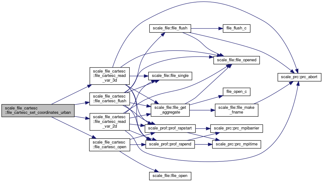
References scale_atmos_grid_cartesc::atmos_grid_cartesc_cx, scale_atmos_grid_cartesc::atmos_grid_cartesc_cy, scale_atmos_grid_cartesc::atmos_grid_cartesc_cz, file_cartesc_flush(), file_cartesc_open(), file_cartesc_read_var_2d(), file_cartesc_read_var_3d(), scale_atmos_grid_cartesc_index::ieb, scale_atmos_grid_cartesc_index::isb, scale_atmos_grid_cartesc_index::jeb, scale_atmos_grid_cartesc_index::jsb, scale_atmos_grid_cartesc_index::ke, scale_atmos_grid_cartesc_index::ks, scale_land_grid_cartesc::land_grid_cartesc_cz, scale_land_grid_cartesc_index::lke, scale_land_grid_cartesc_index::lks, scale_ocean_grid_cartesc::ocean_grid_cartesc_cz, scale_ocean_grid_cartesc_index::oke, scale_ocean_grid_cartesc_index::oks, scale_urban_grid_cartesc_index::uke, scale_urban_grid_cartesc_index::uks, and scale_urban_grid_cartesc::urban_grid_cartesc_cz.
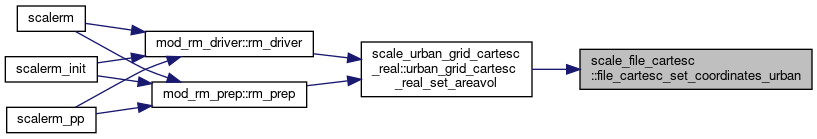
Referenced by scale_urban_grid_cartesc_real::urban_grid_cartesc_real_set_areavol().
◆ file_cartesc_open()
| subroutine, public scale_file_cartesc::file_cartesc_open | ( | character(len=*), intent(in) | basename, |
| integer, intent(out) | fid, | ||
| logical, intent(in), optional | aggregate | ||
| ) |
open a netCDF file for read
- Parameters
-
[in] basename basename of the file [out] fid file ID
Definition at line 746 of file scale_file_cartesC.F90.
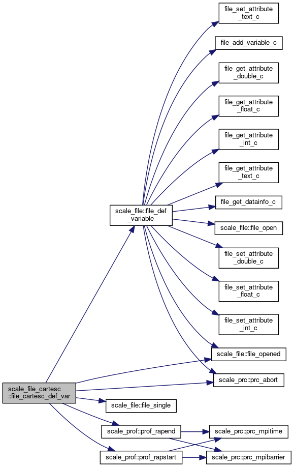
References scale_file::file_aggregate, scale_file_h::file_fread, scale_file::file_open(), scale_prc::prc_myrank, scale_prof::prof_rapend(), and scale_prof::prof_rapstart().
Referenced by mod_atmos_bnd_driver::atmos_boundary_driver_set(), mod_atmos_dyn_vars::atmos_dyn_vars_restart_open(), mod_atmos_phy_ae_vars::atmos_phy_ae_vars_restart_open(), mod_atmos_phy_bl_vars::atmos_phy_bl_vars_restart_open(), mod_atmos_phy_ch_vars::atmos_phy_ch_vars_restart_open(), mod_atmos_phy_cp_vars::atmos_phy_cp_vars_restart_open(), mod_atmos_phy_lt_vars::atmos_phy_lt_vars_restart_open(), mod_atmos_phy_mp_vars::atmos_phy_mp_vars_restart_open(), mod_atmos_phy_rd_vars::atmos_phy_rd_vars_restart_open(), mod_atmos_phy_sf_vars::atmos_phy_sf_vars_restart_open(), mod_atmos_phy_tb_vars::atmos_phy_tb_vars_restart_open(), scale_atmos_refstate::atmos_refstate_read(), mod_atmos_vars::atmos_vars_restart_check(), mod_atmos_vars::atmos_vars_restart_open(), file_cartesc_read_1d(), file_cartesc_set_coordinates_urban(), mod_land_vars::land_vars_restart_open(), scale_landuse::landuse_fillhalo(), mod_ocean_vars::ocean_vars_restart_open(), scale_topography::topography_fillhalo(), scale_urban_dyn_kusaka01::urban_dyn_kusaka01(), and mod_urban_vars::urban_vars_restart_open().

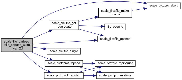
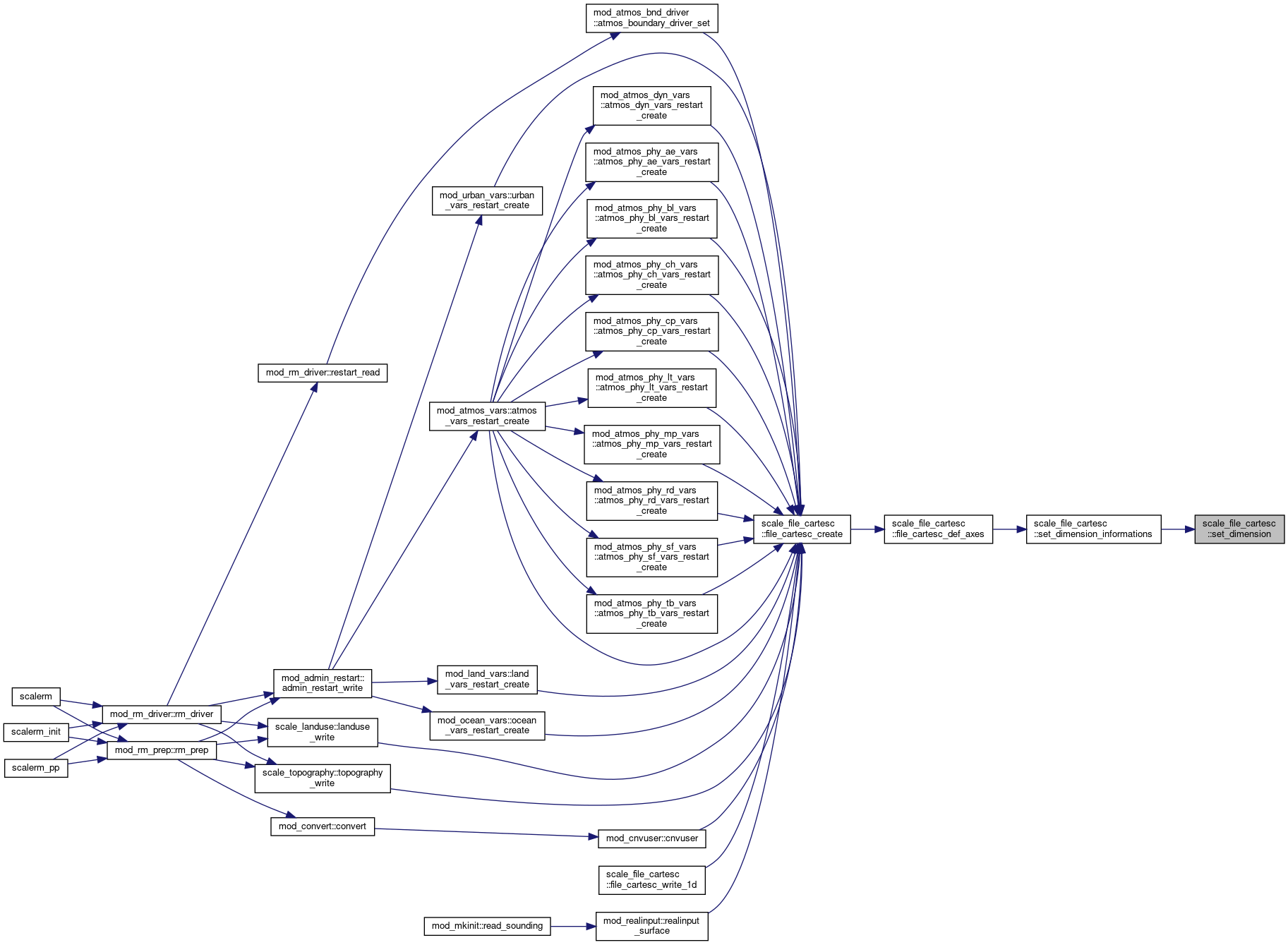
◆ file_cartesc_create()
| subroutine, public scale_file_cartesc::file_cartesc_create | ( | character(len=*), intent(in) | basename, |
| character(len=*), intent(in) | title, | ||
| character(len=*), intent(in) | datatype, | ||
| integer, intent(out) | fid, | ||
| integer, dimension(6), intent(in), optional | date, | ||
| real(dp), intent(in), optional | subsec, | ||
| logical, intent(in), optional | haszcoord, | ||
| logical, intent(in), optional | append, | ||
| logical, intent(in), optional | aggregate, | ||
| logical, intent(in), optional | single | ||
| ) |
Create/open a netCDF file.
- Parameters
-
[in] basename basename of the file [in] title title of the file [in] datatype data type (REAL8/REAL4/default) [out] fid file ID [in] date ymdhms of the time [in] subsec subsec of the time [in] append switch whether append existing file or not (default=false) [in] haszcoord switch whether include zcoordinate or not (default=true)
Definition at line 780 of file scale_file_cartesC.F90.
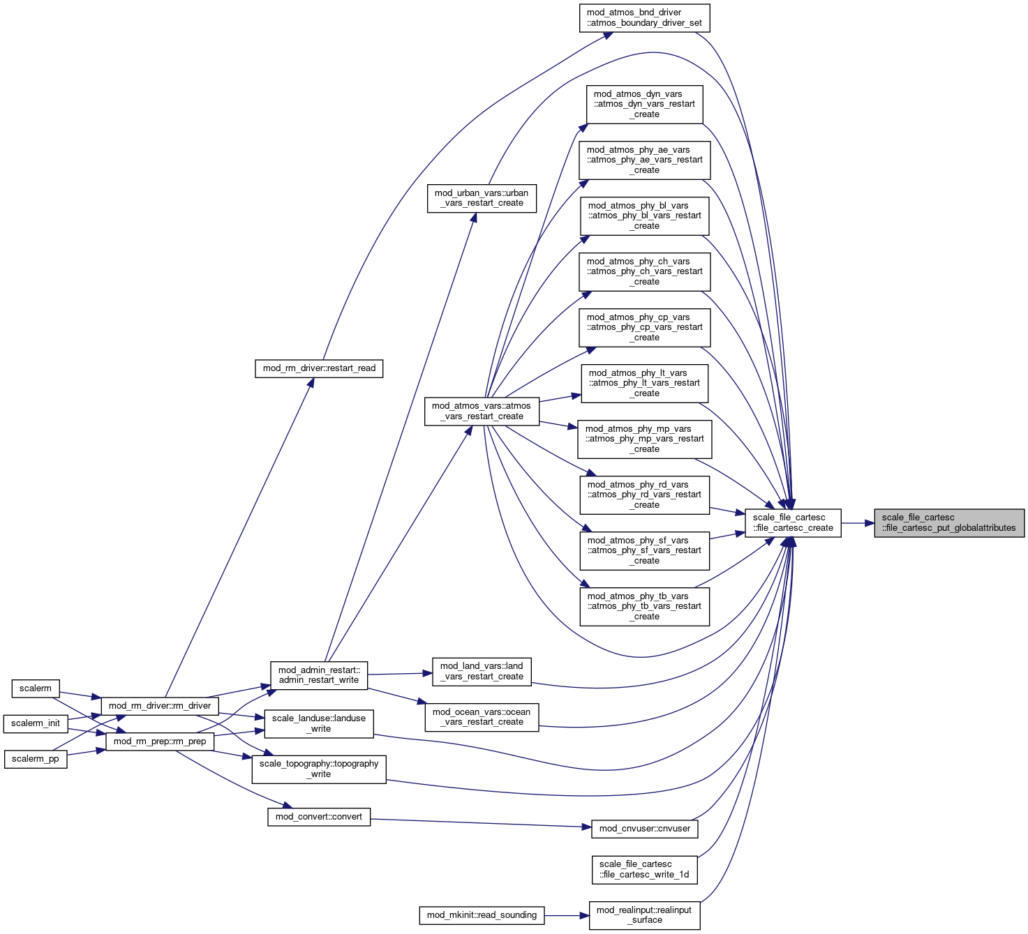
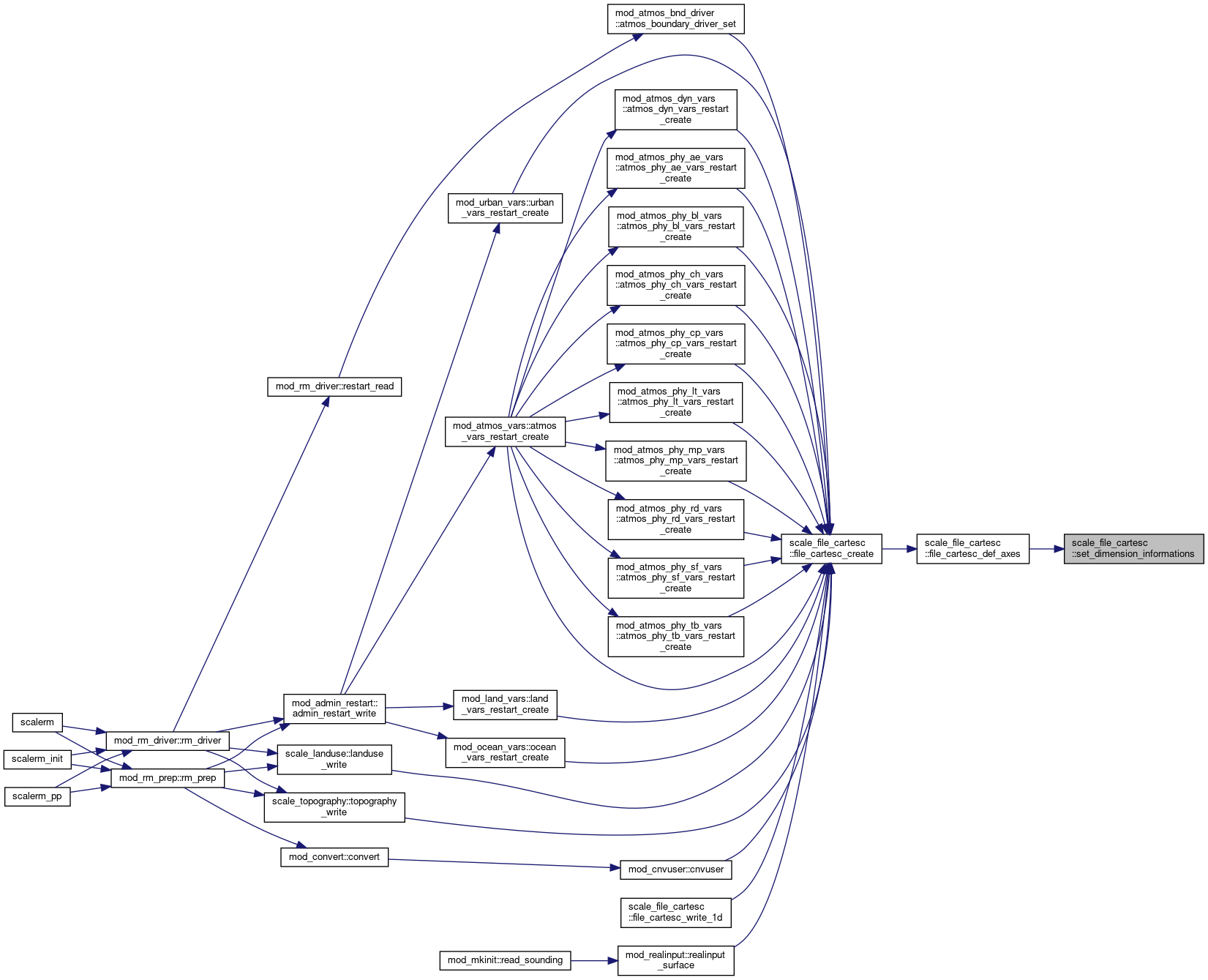
References scale_calendar::calendar_get_name(), scale_file::file_aggregate, file_cartesc_def_axes(), file_cartesc_put_globalattributes(), scale_file::file_create(), scale_file::file_get_cftunits(), scale_file_h::file_real4, scale_file_h::file_real8, scale_io::h_institute, scale_io::h_source, scale_atmos_grid_cartesc_index::ihalo, scale_atmos_grid_cartesc_index::imaxg, scale_atmos_grid_cartesc_index::jhalo, scale_atmos_grid_cartesc_index::jmaxg, scale_atmos_grid_cartesc_index::khalo, scale_atmos_grid_cartesc_index::kmax, scale_land_grid_cartesc_index::lkmax, scale_ocean_grid_cartesc_index::okmax, scale_prc_cartesc::prc_2drank, scale_prc::prc_abort(), scale_prc::prc_myrank, scale_prc_cartesc::prc_num_x, scale_prc_cartesc::prc_num_y, scale_prc_cartesc::prc_periodic_x, scale_prc_cartesc::prc_periodic_y, scale_prof::prof_rapend(), scale_prof::prof_rapstart(), scale_precision::rp, scale_time::time_nowdate, scale_time::time_nowsubsec, and scale_urban_grid_cartesc_index::ukmax.
Referenced by mod_atmos_bnd_driver::atmos_boundary_driver_set(), mod_atmos_dyn_vars::atmos_dyn_vars_restart_create(), mod_atmos_phy_ae_vars::atmos_phy_ae_vars_restart_create(), mod_atmos_phy_bl_vars::atmos_phy_bl_vars_restart_create(), mod_atmos_phy_ch_vars::atmos_phy_ch_vars_restart_create(), mod_atmos_phy_cp_vars::atmos_phy_cp_vars_restart_create(), mod_atmos_phy_lt_vars::atmos_phy_lt_vars_restart_create(), mod_atmos_phy_mp_vars::atmos_phy_mp_vars_restart_create(), mod_atmos_phy_rd_vars::atmos_phy_rd_vars_restart_create(), mod_atmos_phy_sf_vars::atmos_phy_sf_vars_restart_create(), mod_atmos_phy_tb_vars::atmos_phy_tb_vars_restart_create(), mod_atmos_vars::atmos_vars_restart_create(), mod_cnvuser::cnvuser(), file_cartesc_write_1d(), mod_land_vars::land_vars_restart_create(), scale_landuse::landuse_write(), mod_ocean_vars::ocean_vars_restart_create(), mod_realinput::realinput_surface(), scale_topography::topography_write(), and mod_urban_vars::urban_vars_restart_create().
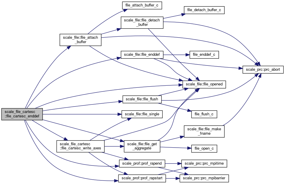
◆ file_cartesc_enddef()
| subroutine, public scale_file_cartesc::file_cartesc_enddef | ( | integer, intent(in) | fid | ) |
Exit netCDF file define mode.
- Parameters
-
[in] fid file ID
Definition at line 943 of file scale_file_cartesC.F90.
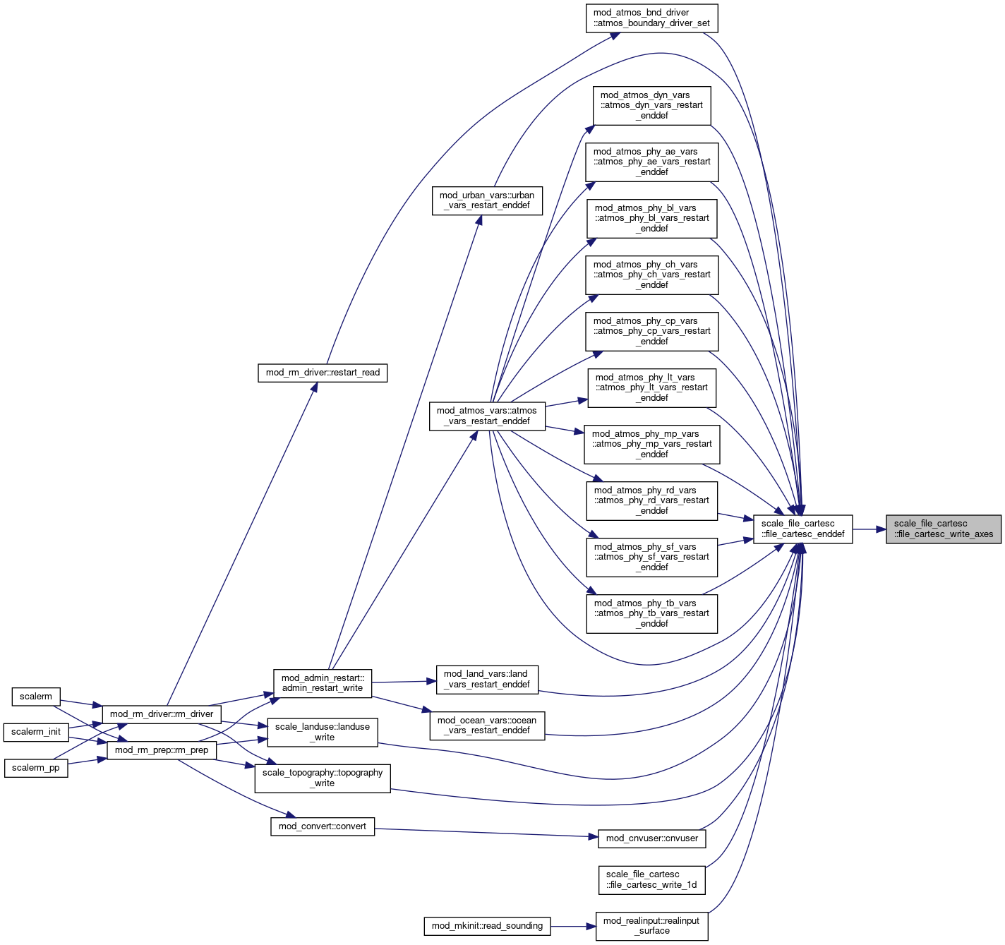
References scale_file::file_attach_buffer(), file_cartesc_write_axes(), scale_file::file_enddef(), scale_file::file_flush(), scale_file::file_get_aggregate(), scale_file::file_opened(), scale_file::file_single(), scale_atmos_grid_cartesc_index::isga, scale_atmos_grid_cartesc_index::jsga, scale_prof::prof_rapend(), and scale_prof::prof_rapstart().
Referenced by mod_atmos_bnd_driver::atmos_boundary_driver_set(), mod_atmos_dyn_vars::atmos_dyn_vars_restart_enddef(), mod_atmos_phy_ae_vars::atmos_phy_ae_vars_restart_enddef(), mod_atmos_phy_bl_vars::atmos_phy_bl_vars_restart_enddef(), mod_atmos_phy_ch_vars::atmos_phy_ch_vars_restart_enddef(), mod_atmos_phy_cp_vars::atmos_phy_cp_vars_restart_enddef(), mod_atmos_phy_lt_vars::atmos_phy_lt_vars_restart_enddef(), mod_atmos_phy_mp_vars::atmos_phy_mp_vars_restart_enddef(), mod_atmos_phy_rd_vars::atmos_phy_rd_vars_restart_enddef(), mod_atmos_phy_sf_vars::atmos_phy_sf_vars_restart_enddef(), mod_atmos_phy_tb_vars::atmos_phy_tb_vars_restart_enddef(), mod_atmos_vars::atmos_vars_restart_enddef(), mod_cnvuser::cnvuser(), file_cartesc_write_1d(), mod_land_vars::land_vars_restart_enddef(), scale_landuse::landuse_write(), mod_ocean_vars::ocean_vars_restart_enddef(), mod_realinput::realinput_surface(), scale_topography::topography_write(), and mod_urban_vars::urban_vars_restart_enddef().

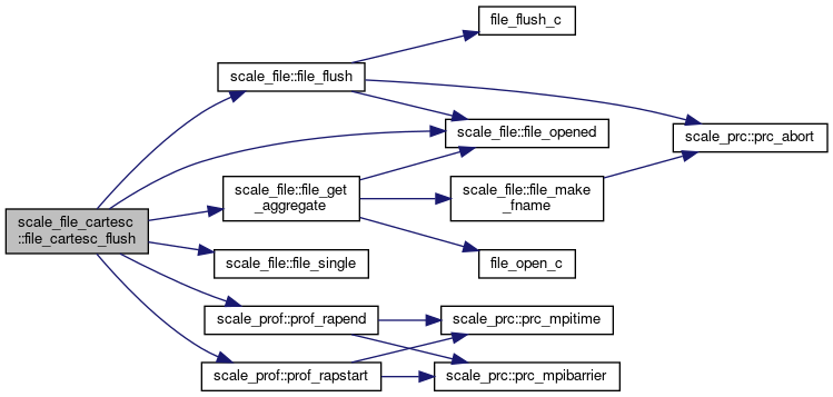
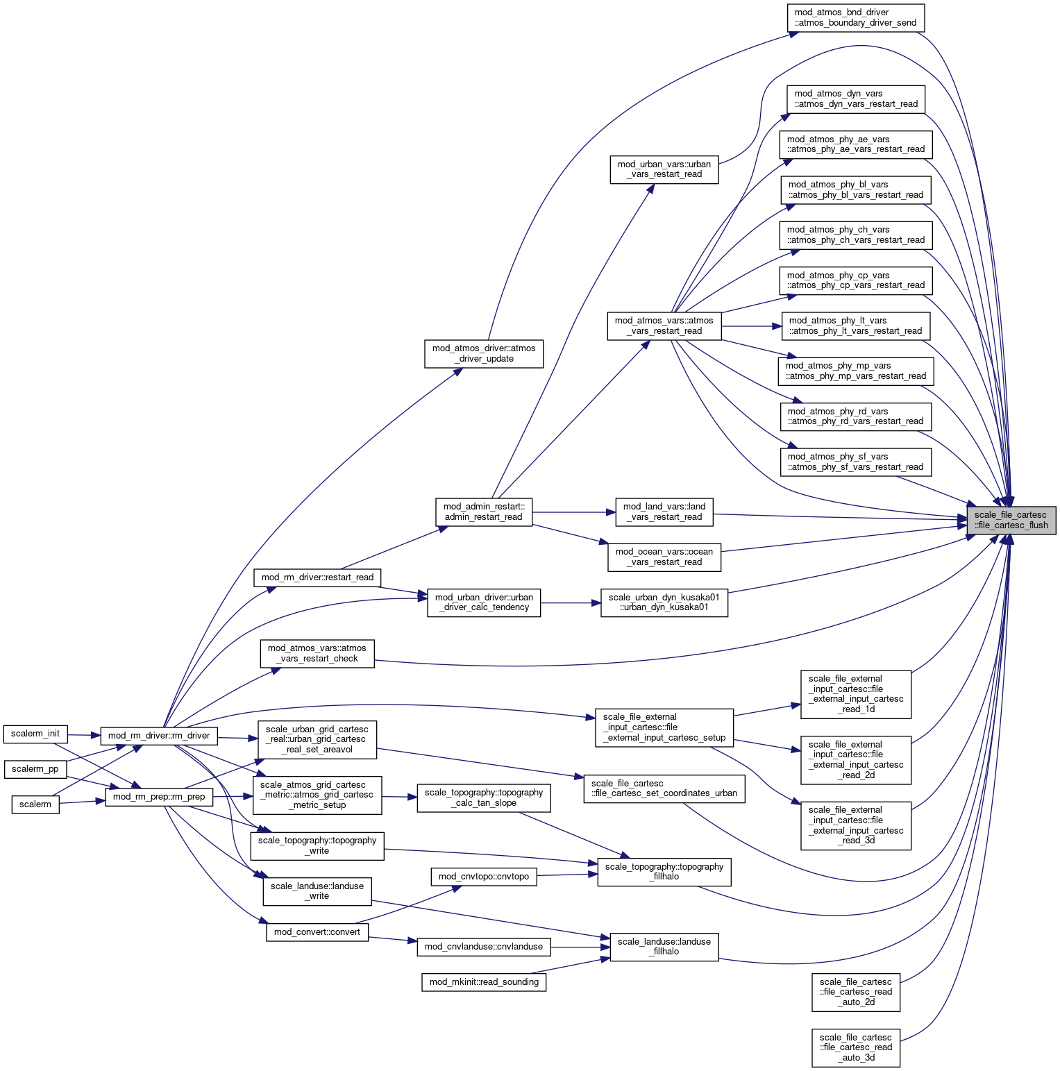
◆ file_cartesc_flush()
| subroutine, public scale_file_cartesc::file_cartesc_flush | ( | integer, intent(in) | fid | ) |
Flush all pending requests to a netCDF file (PnetCDF only)
- Parameters
-
[in] fid file ID
Definition at line 997 of file scale_file_cartesC.F90.
References scale_file::file_flush(), scale_file::file_get_aggregate(), scale_file::file_opened(), scale_file::file_single(), scale_prof::prof_rapend(), and scale_prof::prof_rapstart().
Referenced by mod_atmos_bnd_driver::atmos_boundary_driver_send(), mod_atmos_dyn_vars::atmos_dyn_vars_restart_read(), mod_atmos_phy_ae_vars::atmos_phy_ae_vars_restart_read(), mod_atmos_phy_bl_vars::atmos_phy_bl_vars_restart_read(), mod_atmos_phy_ch_vars::atmos_phy_ch_vars_restart_read(), mod_atmos_phy_cp_vars::atmos_phy_cp_vars_restart_read(), mod_atmos_phy_lt_vars::atmos_phy_lt_vars_restart_read(), mod_atmos_phy_mp_vars::atmos_phy_mp_vars_restart_read(), mod_atmos_phy_rd_vars::atmos_phy_rd_vars_restart_read(), mod_atmos_phy_sf_vars::atmos_phy_sf_vars_restart_read(), mod_atmos_vars::atmos_vars_restart_check(), mod_atmos_vars::atmos_vars_restart_read(), file_cartesc_read_auto_2d(), file_cartesc_read_auto_3d(), file_cartesc_set_coordinates_urban(), scale_file_external_input_cartesc::file_external_input_cartesc_read_1d(), scale_file_external_input_cartesc::file_external_input_cartesc_read_2d(), scale_file_external_input_cartesc::file_external_input_cartesc_read_3d(), mod_land_vars::land_vars_restart_read(), scale_landuse::landuse_fillhalo(), mod_ocean_vars::ocean_vars_restart_read(), scale_topography::topography_fillhalo(), scale_urban_dyn_kusaka01::urban_dyn_kusaka01(), and mod_urban_vars::urban_vars_restart_read().
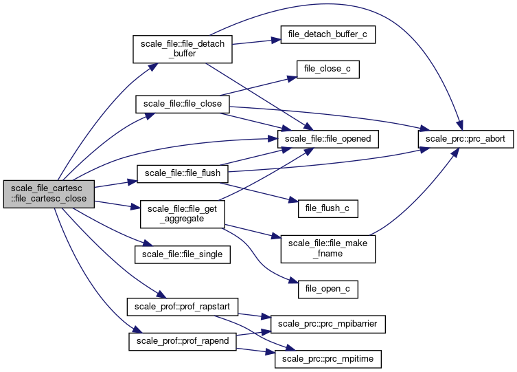
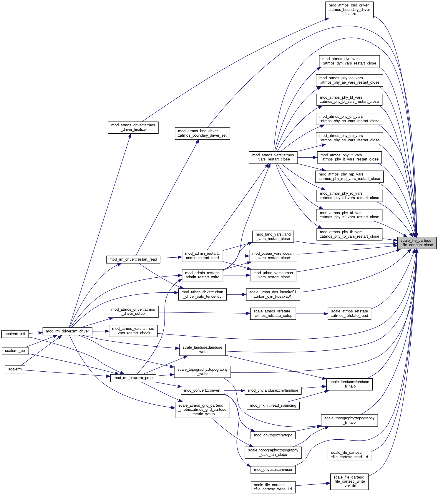
◆ file_cartesc_close()
| subroutine, public scale_file_cartesc::file_cartesc_close | ( | integer, intent(in) | fid | ) |
Close a netCDF file.
- Parameters
-
[in] fid file ID
Definition at line 1023 of file scale_file_cartesC.F90.
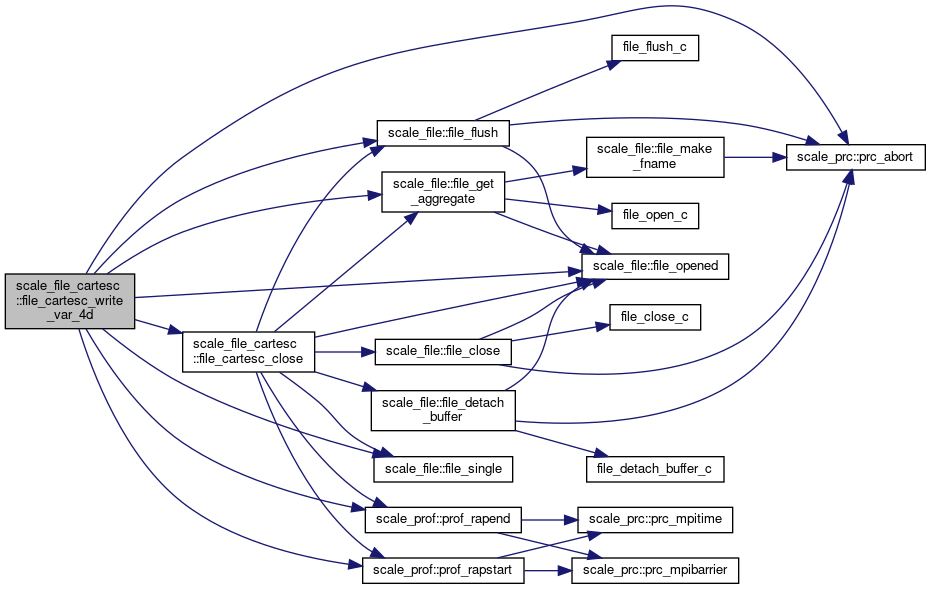
References scale_file::file_close(), scale_file::file_detach_buffer(), scale_file::file_flush(), scale_file::file_get_aggregate(), scale_file::file_opened(), scale_file::file_single(), scale_prof::prof_rapend(), and scale_prof::prof_rapstart().
Referenced by mod_atmos_bnd_driver::atmos_boundary_driver_finalize(), mod_atmos_bnd_driver::atmos_boundary_driver_set(), mod_atmos_dyn_vars::atmos_dyn_vars_restart_close(), mod_atmos_phy_ae_vars::atmos_phy_ae_vars_restart_close(), mod_atmos_phy_bl_vars::atmos_phy_bl_vars_restart_close(), mod_atmos_phy_ch_vars::atmos_phy_ch_vars_restart_close(), mod_atmos_phy_cp_vars::atmos_phy_cp_vars_restart_close(), mod_atmos_phy_lt_vars::atmos_phy_lt_vars_restart_close(), mod_atmos_phy_mp_vars::atmos_phy_mp_vars_restart_close(), mod_atmos_phy_rd_vars::atmos_phy_rd_vars_restart_close(), mod_atmos_phy_sf_vars::atmos_phy_sf_vars_restart_close(), mod_atmos_phy_tb_vars::atmos_phy_tb_vars_restart_close(), scale_atmos_refstate::atmos_refstate_read(), mod_atmos_vars::atmos_vars_restart_check(), mod_atmos_vars::atmos_vars_restart_close(), mod_cnvuser::cnvuser(), file_cartesc_read_1d(), file_cartesc_write_var_4d(), mod_land_vars::land_vars_restart_close(), scale_landuse::landuse_fillhalo(), scale_landuse::landuse_write(), mod_ocean_vars::ocean_vars_restart_close(), scale_topography::topography_fillhalo(), scale_topography::topography_write(), scale_urban_dyn_kusaka01::urban_dyn_kusaka01(), and mod_urban_vars::urban_vars_restart_close().
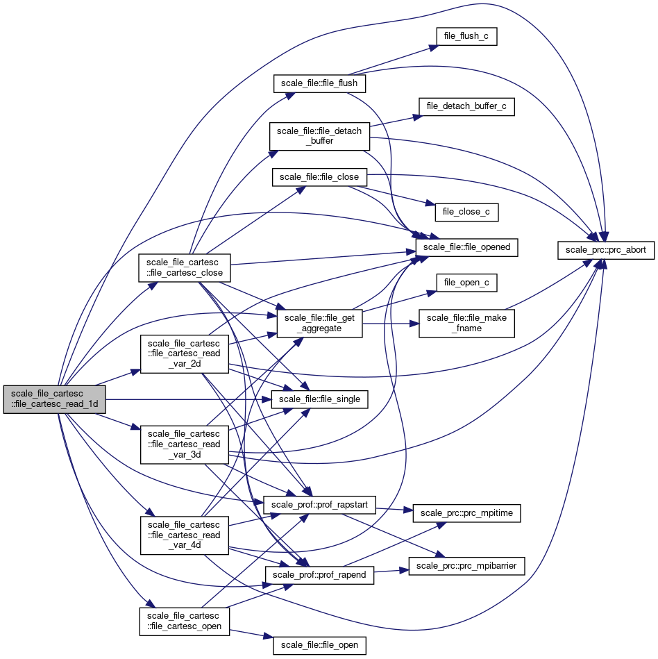
◆ file_cartesc_read_1d()
| subroutine scale_file_cartesc::file_cartesc_read_1d | ( | character(len=*), intent(in) | basename, |
| character(len=*), intent(in) | varname, | ||
| character(len=*), intent(in) | dim_type, | ||
| real(rp), dimension(:), intent(out) | var, | ||
| integer, intent(in), optional | step, | ||
| logical, intent(in), optional | aggregate, | ||
| logical, intent(in), optional | allow_missing | ||
| ) |
interface FILE_CARTESC_read Read data from file This routine is a wrapper of the lower primitive routines
- Parameters
-
[in] basename basename of the file [in] varname name of the variable [in] dim_type dimension type (Z/X/Y) [out] var value of the variable [in] step step number
Definition at line 1067 of file scale_file_cartesC.F90.
References file_cartesc_close(), file_cartesc_open(), file_cartesc_read_var_2d(), file_cartesc_read_var_3d(), file_cartesc_read_var_4d(), scale_file::file_get_aggregate(), scale_file::file_opened(), scale_file::file_single(), scale_atmos_grid_cartesc_index::ia, scale_atmos_grid_cartesc_index::ieb, scale_atmos_grid_cartesc_index::ihalo, scale_atmos_grid_cartesc_index::is_ing, scale_atmos_grid_cartesc_index::isb, scale_atmos_grid_cartesc_index::ja, scale_atmos_grid_cartesc_index::jeb, scale_atmos_grid_cartesc_index::jhalo, scale_atmos_grid_cartesc_index::js_ing, scale_atmos_grid_cartesc_index::jsb, scale_atmos_grid_cartesc_index::ka, scale_atmos_grid_cartesc_index::ke, scale_atmos_grid_cartesc_index::ks, scale_land_grid_cartesc_index::lka, scale_land_grid_cartesc_index::lke, scale_land_grid_cartesc_index::lks, scale_ocean_grid_cartesc_index::oka, scale_ocean_grid_cartesc_index::oke, scale_ocean_grid_cartesc_index::oks, scale_prc::prc_abort(), scale_prc_cartesc::prc_num_x, scale_prc_cartesc::prc_num_y, scale_prof::prof_rapend(), scale_prof::prof_rapstart(), scale_urban_grid_cartesc_index::uka, scale_urban_grid_cartesc_index::uke, and scale_urban_grid_cartesc_index::uks.
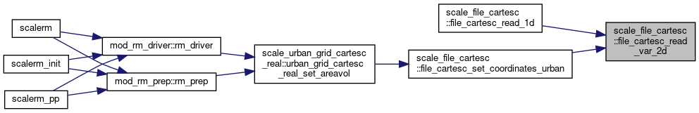
◆ file_cartesc_read_var_2d()
| subroutine scale_file_cartesc::file_cartesc_read_var_2d | ( | integer, intent(in) | fid, |
| character(len=*), intent(in) | varname, | ||
| character(len=*), intent(in) | dim_type, | ||
| real(rp), dimension(:,:), intent(out) | var, | ||
| integer, intent(in), optional | step, | ||
| logical, intent(in), optional | allow_missing | ||
| ) |
Read 2D data from file.
- Parameters
-
[in] fid file ID [in] varname name of the variable [in] dim_type dimension type (Z/X/Y) [out] var value of the variable [in] step step number
Definition at line 1350 of file scale_file_cartesC.F90.
References scale_file::file_get_aggregate(), scale_file::file_opened(), scale_file::file_single(), scale_atmos_grid_cartesc_index::ia, scale_atmos_grid_cartesc_index::ieb, scale_atmos_grid_cartesc_index::isb, scale_atmos_grid_cartesc_index::ja, scale_atmos_grid_cartesc_index::jeb, scale_atmos_grid_cartesc_index::jsb, scale_atmos_grid_cartesc_index::ka, scale_atmos_grid_cartesc_index::ke, scale_atmos_grid_cartesc_index::ks, scale_prc::prc_abort(), scale_prof::prof_rapend(), and scale_prof::prof_rapstart().
Referenced by file_cartesc_read_1d(), and file_cartesc_set_coordinates_urban().

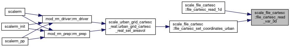
◆ file_cartesc_read_var_3d()
| subroutine scale_file_cartesc::file_cartesc_read_var_3d | ( | integer, intent(in) | fid, |
| character(len=*), intent(in) | varname, | ||
| character(len=*), intent(in) | dim_type, | ||
| real(rp), dimension(:,:,:), intent(out) | var, | ||
| integer, intent(in), optional | step, | ||
| logical, intent(in), optional | allow_missing | ||
| ) |
Read 3D data from file.
- Parameters
-
[in] fid file ID [in] varname name of the variable [in] dim_type dimension type (Z/X/Y/T) [out] var value of the variable [in] step step number
Definition at line 1450 of file scale_file_cartesC.F90.
References scale_file::file_get_aggregate(), scale_file::file_opened(), scale_file::file_single(), scale_atmos_grid_cartesc_index::ia, scale_atmos_grid_cartesc_index::ieb, scale_atmos_grid_cartesc_index::isb, scale_atmos_grid_cartesc_index::ja, scale_atmos_grid_cartesc_index::jeb, scale_atmos_grid_cartesc_index::jsb, scale_atmos_grid_cartesc_index::ka, scale_atmos_grid_cartesc_index::ke, scale_atmos_grid_cartesc_index::ks, scale_land_grid_cartesc_index::lia, scale_land_grid_cartesc_index::lja, scale_land_grid_cartesc_index::lka, scale_land_grid_cartesc_index::lke, scale_land_grid_cartesc_index::lks, scale_ocean_grid_cartesc_index::oia, scale_ocean_grid_cartesc_index::oja, scale_ocean_grid_cartesc_index::oka, scale_ocean_grid_cartesc_index::oke, scale_ocean_grid_cartesc_index::oks, scale_prc::prc_abort(), scale_prc_cartesc::prc_num_x, scale_prc_cartesc::prc_num_y, scale_prof::prof_rapend(), scale_prof::prof_rapstart(), scale_urban_grid_cartesc_index::uia, scale_urban_grid_cartesc_index::uja, scale_urban_grid_cartesc_index::uka, scale_urban_grid_cartesc_index::uke, and scale_urban_grid_cartesc_index::uks.
Referenced by file_cartesc_read_1d(), and file_cartesc_set_coordinates_urban().

◆ file_cartesc_read_var_4d()
| subroutine scale_file_cartesc::file_cartesc_read_var_4d | ( | integer, intent(in) | fid, |
| character(len=*), intent(in) | varname, | ||
| character(len=*), intent(in) | dim_type, | ||
| integer, intent(in) | step, | ||
| real(rp), dimension(:,:,:,:), intent(out) | var, | ||
| logical, intent(in), optional | allow_missing | ||
| ) |
Read 4D data from file.
- Parameters
-
[in] fid file ID [in] varname name of the variable [in] dim_type dimension type (Z/X/Y/Time) [in] step step number [out] var value of the variable
Definition at line 1629 of file scale_file_cartesC.F90.
References scale_file::file_get_aggregate(), scale_file::file_opened(), scale_file::file_single(), scale_atmos_grid_cartesc_index::ia, scale_atmos_grid_cartesc_index::ieb, scale_atmos_grid_cartesc_index::isb, scale_atmos_grid_cartesc_index::ja, scale_atmos_grid_cartesc_index::jeb, scale_atmos_grid_cartesc_index::jsb, scale_atmos_grid_cartesc_index::ka, scale_atmos_grid_cartesc_index::ke, scale_atmos_grid_cartesc_index::ks, scale_land_grid_cartesc_index::lia, scale_land_grid_cartesc_index::lja, scale_land_grid_cartesc_index::lka, scale_land_grid_cartesc_index::lke, scale_land_grid_cartesc_index::lks, scale_ocean_grid_cartesc_index::oia, scale_ocean_grid_cartesc_index::oja, scale_ocean_grid_cartesc_index::oka, scale_ocean_grid_cartesc_index::oke, scale_ocean_grid_cartesc_index::oks, scale_prc::prc_abort(), scale_prc_cartesc::prc_num_x, scale_prc_cartesc::prc_num_y, scale_prof::prof_rapend(), scale_prof::prof_rapstart(), scale_urban_grid_cartesc_index::uia, scale_urban_grid_cartesc_index::uja, and scale_urban_grid_cartesc_index::uka.
Referenced by file_cartesc_read_1d().

◆ file_cartesc_read_auto_2d()
| subroutine scale_file_cartesc::file_cartesc_read_auto_2d | ( | integer, intent(in) | fid, |
| character(len=*), intent(in) | varname, | ||
| real(rp), dimension(:,:), intent(out) | var, | ||
| integer, intent(in), optional | step, | ||
| logical, intent(out), optional | existed | ||
| ) |
Read 2D data from file.
- Parameters
-
[in] fid file ID [in] varname name of the variable [out] var value of the variable [in] step step number
Definition at line 1783 of file scale_file_cartesC.F90.
References file_cartesc_flush(), scale_file::file_opened(), scale_file::file_single(), scale_prc::prc_abort(), scale_prof::prof_rapend(), and scale_prof::prof_rapstart().

◆ file_cartesc_read_auto_3d()
| subroutine scale_file_cartesc::file_cartesc_read_auto_3d | ( | integer, intent(in) | fid, |
| character(len=*), intent(in) | varname, | ||
| real(rp), dimension(:,:,:), intent(out) | var, | ||
| integer, intent(in), optional | step, | ||
| logical, intent(out), optional | existed | ||
| ) |
Read 3D data from file.
- Parameters
-
[in] fid file ID [in] varname name of the variable [out] var value of the variable [in] step step number
Definition at line 1866 of file scale_file_cartesC.F90.
References file_cartesc_flush(), scale_file::file_opened(), scale_file::file_single(), scale_prc::prc_abort(), scale_prof::prof_rapend(), and scale_prof::prof_rapstart().
◆ file_cartesc_write_1d()
| subroutine scale_file_cartesc::file_cartesc_write_1d | ( | real(rp), dimension(:), intent(in) | var, |
| character(len=*), intent(in) | basename, | ||
| character(len=*), intent(in) | title, | ||
| character(len=*), intent(in) | varname, | ||
| character(len=*), intent(in) | desc, | ||
| character(len=*), intent(in) | unit, | ||
| character(len=*), intent(in) | dim_type, | ||
| character(len=*), intent(in) | datatype, | ||
| integer, dimension(6), intent(in), optional | date, | ||
| real(dp), intent(in), optional | subsec, | ||
| logical, intent(in), optional | append, | ||
| logical, intent(in), optional | aggregate, | ||
| character(len=*), intent(in), optional | standard_name, | ||
| character(len=*), intent(in), optional | cell_measures | ||
| ) |
interface FILE_CARTESC_write Write data to file This routine is a wrapper of the lowere primitive routines
- Parameters
-
[in] var value of the variable [in] basename basename of the file [in] title title of the file [in] varname name of the variable [in] desc description of the variable [in] unit unit of the variable [in] dim_type dimension type (Z/X/Y) [in] datatype data type (REAL8/REAL4/default) [in] date ymdhms of the time [in] subsec subsec of the time [in] append switch whether append existing file or not (default=false)
Definition at line 2000 of file scale_file_cartesC.F90.
References file_cartesc_create(), file_cartesc_def_var(), file_cartesc_enddef(), file_cartesc_write_var_1d(), file_cartesc_write_var_2d(), file_cartesc_write_var_3d(), file_cartesc_write_var_3d_t(), and file_cartesc_write_var_4d().
◆ file_cartesc_put_globalattributes()
| subroutine, public scale_file_cartesc::file_cartesc_put_globalattributes | ( | integer, intent(in) | fid, |
| integer, intent(in) | prc_rank_x, | ||
| integer, intent(in) | prc_rank_y, | ||
| integer, intent(in) | prc_num_x, | ||
| integer, intent(in) | prc_num_y, | ||
| logical, intent(in) | prc_periodic_x, | ||
| logical, intent(in) | prc_periodic_y, | ||
| integer, intent(in) | kmax, | ||
| integer, intent(in) | okmax, | ||
| integer, intent(in) | lkmax, | ||
| integer, intent(in) | ukmax, | ||
| integer, intent(in) | imaxg, | ||
| integer, intent(in) | jmaxg, | ||
| integer, intent(in) | khalo, | ||
| integer, intent(in) | ihalo, | ||
| integer, intent(in) | jhalo, | ||
| real(dp), intent(in) | time, | ||
| character(len=*), intent(in) | tunits, | ||
| character(len=*), intent(in) | calendar | ||
| ) |
put global attributes
Definition at line 2292 of file scale_file_cartesC.F90.
References scale_atmos_grid_cartesc::atmos_grid_cartesc_name, scale_file::file_opened(), scale_file::file_single(), scale_atmos_grid_cartesc_index::ihalo, scale_atmos_grid_cartesc_index::imaxg, scale_atmos_grid_cartesc_index::jhalo, scale_atmos_grid_cartesc_index::jmaxg, scale_atmos_grid_cartesc_index::khalo, scale_atmos_grid_cartesc_index::kmax, scale_land_grid_cartesc_index::lkmax, scale_ocean_grid_cartesc_index::okmax, scale_prof::prof_rapend(), scale_prof::prof_rapstart(), and scale_urban_grid_cartesc_index::ukmax.
Referenced by file_cartesc_create().
◆ file_cartesc_def_axes()
| subroutine scale_file_cartesc::file_cartesc_def_axes | ( | integer, intent(in) | fid, |
| integer, intent(in) | dtype, | ||
| logical, intent(in) | hasZ | ||
| ) |
define axis variables in the file
Definition at line 2356 of file scale_file_cartesC.F90.
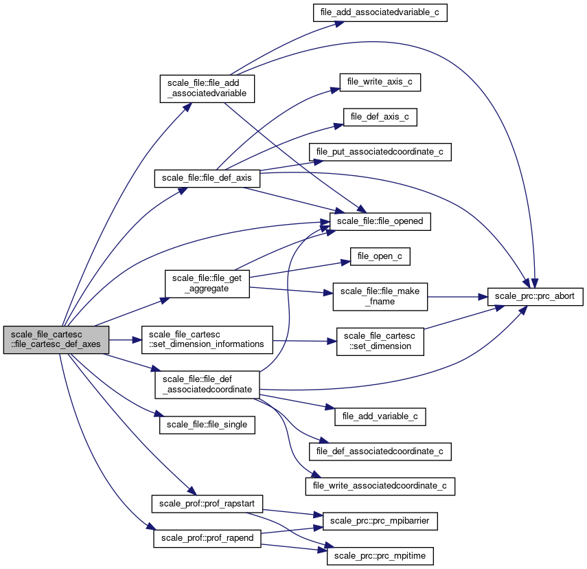
References scale_const::const_undef, scale_file::file_add_associatedvariable(), scale_file::file_def_associatedcoordinate(), scale_file::file_def_axis(), scale_file::file_get_aggregate(), scale_file::file_opened(), scale_file::file_single(), scale_atmos_grid_cartesc_index::ia, scale_atmos_grid_cartesc_index::iag, scale_atmos_grid_cartesc_index::ihalo, scale_atmos_grid_cartesc_index::imaxb, scale_atmos_grid_cartesc_index::ja, scale_atmos_grid_cartesc_index::jag, scale_atmos_grid_cartesc_index::jhalo, scale_atmos_grid_cartesc_index::jmaxb, scale_atmos_grid_cartesc_index::ka, scale_atmos_grid_cartesc_index::kmax, scale_land_grid_cartesc_index::lkmax, scale_mapprojection::mapprojection_mappinginfo, scale_ocean_grid_cartesc_index::okmax, scale_prof::prof_rapend(), scale_prof::prof_rapstart(), set_dimension_informations(), and scale_urban_grid_cartesc_index::ukmax.
Referenced by file_cartesc_create().

◆ file_cartesc_write_axes()
| subroutine scale_file_cartesc::file_cartesc_write_axes | ( | integer, intent(in) | fid, |
| logical, intent(in) | haszcoord, | ||
| integer, dimension(3), intent(in) | start | ||
| ) |
write axis to the file
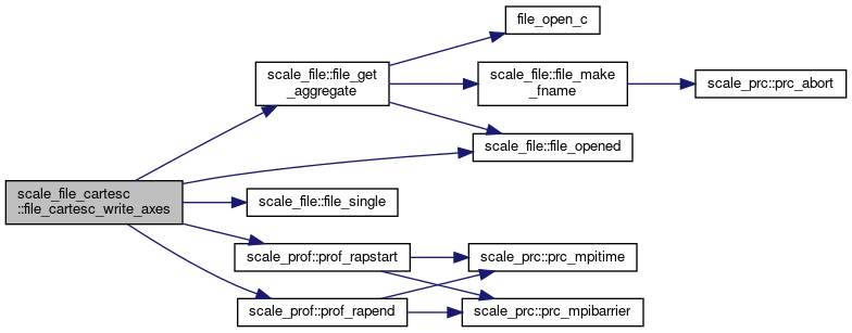
Definition at line 2839 of file scale_file_cartesC.F90.
References scale_atmos_grid_cartesc::atmos_grid_cartesc_cbfx, scale_atmos_grid_cartesc::atmos_grid_cartesc_cbfxg, scale_atmos_grid_cartesc::atmos_grid_cartesc_cbfy, scale_atmos_grid_cartesc::atmos_grid_cartesc_cbfyg, scale_atmos_grid_cartesc::atmos_grid_cartesc_cbfz, scale_atmos_grid_cartesc::atmos_grid_cartesc_cdx, scale_atmos_grid_cartesc::atmos_grid_cartesc_cdxg, scale_atmos_grid_cartesc::atmos_grid_cartesc_cdy, scale_atmos_grid_cartesc::atmos_grid_cartesc_cdyg, scale_atmos_grid_cartesc::atmos_grid_cartesc_cdz, scale_atmos_grid_cartesc::atmos_grid_cartesc_cx, scale_atmos_grid_cartesc::atmos_grid_cartesc_cxg, scale_atmos_grid_cartesc::atmos_grid_cartesc_cy, scale_atmos_grid_cartesc::atmos_grid_cartesc_cyg, scale_atmos_grid_cartesc::atmos_grid_cartesc_cz, scale_atmos_grid_cartesc::atmos_grid_cartesc_fbfx, scale_atmos_grid_cartesc::atmos_grid_cartesc_fbfxg, scale_atmos_grid_cartesc::atmos_grid_cartesc_fbfy, scale_atmos_grid_cartesc::atmos_grid_cartesc_fbfyg, scale_atmos_grid_cartesc::atmos_grid_cartesc_fbfz, scale_atmos_grid_cartesc::atmos_grid_cartesc_fdx, scale_atmos_grid_cartesc::atmos_grid_cartesc_fdxg, scale_atmos_grid_cartesc::atmos_grid_cartesc_fdy, scale_atmos_grid_cartesc::atmos_grid_cartesc_fdyg, scale_atmos_grid_cartesc::atmos_grid_cartesc_fdz, scale_atmos_grid_cartesc::atmos_grid_cartesc_fx, scale_atmos_grid_cartesc::atmos_grid_cartesc_fxg, scale_atmos_grid_cartesc::atmos_grid_cartesc_fy, scale_atmos_grid_cartesc::atmos_grid_cartesc_fyg, scale_atmos_grid_cartesc::atmos_grid_cartesc_fz, scale_const::const_undef, scale_file::file_get_aggregate(), scale_file::file_opened(), scale_file::file_single(), scale_atmos_grid_cartesc_index::ie_ing, scale_atmos_grid_cartesc_index::ieb, scale_atmos_grid_cartesc_index::ihalo, scale_atmos_grid_cartesc_index::is_ing, scale_atmos_grid_cartesc_index::isb, scale_atmos_grid_cartesc_index::je_ing, scale_atmos_grid_cartesc_index::jeb, scale_atmos_grid_cartesc_index::jhalo, scale_atmos_grid_cartesc_index::js_ing, scale_atmos_grid_cartesc_index::jsb, scale_atmos_grid_cartesc_index::ke, scale_atmos_grid_cartesc_index::ks, scale_land_grid_cartesc::land_grid_cartesc_cdz, scale_land_grid_cartesc::land_grid_cartesc_cz, scale_land_grid_cartesc::land_grid_cartesc_fz, scale_land_grid_cartesc_index::lke, scale_land_grid_cartesc_index::lkmax, scale_land_grid_cartesc_index::lks, scale_ocean_grid_cartesc::ocean_grid_cartesc_cdz, scale_ocean_grid_cartesc::ocean_grid_cartesc_cz, scale_ocean_grid_cartesc::ocean_grid_cartesc_fz, scale_ocean_grid_cartesc_index::oke, scale_ocean_grid_cartesc_index::okmax, scale_ocean_grid_cartesc_index::oks, scale_prc_cartesc::prc_2drank, scale_prc::prc_ismaster, scale_prc::prc_myrank, scale_prof::prof_rapend(), scale_prof::prof_rapstart(), scale_urban_grid_cartesc_index::uke, scale_urban_grid_cartesc_index::ukmax, scale_urban_grid_cartesc_index::uks, scale_urban_grid_cartesc::urban_grid_cartesc_cdz, scale_urban_grid_cartesc::urban_grid_cartesc_cz, and scale_urban_grid_cartesc::urban_grid_cartesc_fz.
Referenced by file_cartesc_enddef().
◆ file_cartesc_def_var()
| subroutine, public scale_file_cartesc::file_cartesc_def_var | ( | integer, intent(in) | fid, |
| character(len=*), intent(in) | varname, | ||
| character(len=*), intent(in) | desc, | ||
| character(len=*), intent(in) | unit, | ||
| character(len=*), intent(in) | dim_type, | ||
| character(len=*), intent(in) | datatype, | ||
| integer, intent(out) | vid, | ||
| character(len=*), intent(in), optional | standard_name, | ||
| real(dp), intent(in), optional | timeintv, | ||
| integer, intent(in), optional | nsteps, | ||
| character(len=*), intent(in), optional | cell_measures | ||
| ) |
Define a variable to file.
- Parameters
-
[in] fid file ID [in] varname name of the variable [in] desc description of the variable [in] unit unit of the variable [in] dim_type axis type (Z/X/Y) [in] datatype data type (REAL8/REAL4/default) [out] vid variable ID [in] standard_name standard name of the variable [in] timeintv time interval [sec] [in] nsteps number of time steps [in] cell_measures "area" or "volume"
Definition at line 3307 of file scale_file_cartesC.F90.
References scale_file::file_def_variable(), scale_file::file_opened(), scale_file_h::file_real4, scale_file_h::file_real8, scale_file::file_single(), scale_mapprojection::mapprojection_mappinginfo, scale_prc::prc_abort(), scale_prc_cartesc::prc_twod, scale_prof::prof_rapend(), scale_prof::prof_rapstart(), and scale_precision::rp.
Referenced by mod_atmos_bnd_driver::atmos_boundary_driver_set(), mod_atmos_dyn_vars::atmos_dyn_vars_restart_def_var(), mod_atmos_phy_ae_vars::atmos_phy_ae_vars_restart_def_var(), mod_atmos_phy_bl_vars::atmos_phy_bl_vars_restart_def_var(), mod_atmos_phy_ch_vars::atmos_phy_ch_vars_restart_def_var(), mod_atmos_phy_cp_vars::atmos_phy_cp_vars_restart_def_var(), mod_atmos_phy_lt_vars::atmos_phy_lt_vars_restart_def_var(), mod_atmos_phy_mp_vars::atmos_phy_mp_vars_restart_def_var(), mod_atmos_phy_rd_vars::atmos_phy_rd_vars_restart_def_var(), mod_atmos_phy_sf_vars::atmos_phy_sf_vars_restart_def_var(), mod_atmos_phy_tb_vars::atmos_phy_tb_vars_restart_def_var(), mod_atmos_vars::atmos_vars_restart_def_var(), mod_cnvuser::cnvuser(), file_cartesc_write_1d(), mod_land_vars::land_vars_restart_def_var(), scale_landuse::landuse_write(), mod_ocean_vars::ocean_vars_restart_def_var(), mod_realinput::realinput_surface(), scale_topography::topography_write(), and mod_urban_vars::urban_vars_restart_def_var().

◆ file_cartesc_write_var_1d()
| subroutine scale_file_cartesc::file_cartesc_write_var_1d | ( | integer, intent(in) | fid, |
| integer, intent(in) | vid, | ||
| real(rp), dimension(:), intent(in) | var, | ||
| character(len=*), intent(in) | varname, | ||
| character(len=*), intent(in) | dim_type | ||
| ) |
Write 1D data to file.
- Parameters
-
[in] fid file ID [in] vid netCDF variable ID [in] var value of the variable [in] varname name of the variable [in] dim_type axis type (Z/X/Y)
Definition at line 3500 of file scale_file_cartesC.F90.
References scale_file::file_get_aggregate(), scale_file::file_opened(), scale_file::file_single(), scale_atmos_grid_cartesc_index::ieb, scale_atmos_grid_cartesc_index::isb, scale_atmos_grid_cartesc_index::isga, scale_atmos_grid_cartesc_index::jeb, scale_atmos_grid_cartesc_index::jsb, scale_atmos_grid_cartesc_index::jsga, scale_atmos_grid_cartesc_index::ke, scale_atmos_grid_cartesc_index::ks, scale_prc_cartesc::prc_2drank, scale_prc::prc_abort(), scale_prc::prc_myrank, scale_prof::prof_rapend(), scale_prof::prof_rapstart(), and scale_time::time_nowdaysec.
Referenced by file_cartesc_write_1d().


◆ file_cartesc_write_var_2d()
| subroutine scale_file_cartesc::file_cartesc_write_var_2d | ( | integer, intent(in) | fid, |
| integer, intent(in) | vid, | ||
| real(rp), dimension(:,:), intent(in) | var, | ||
| character(len=*), intent(in) | varname, | ||
| character(len=*), intent(in) | dim_type, | ||
| logical, intent(in), optional | fill_halo | ||
| ) |
Write 2D data to file.
- Parameters
-
[in] fid file ID [in] vid netCDF variable ID [in] var value of the variable [in] varname name of the variable [in] dim_type axis type (Z/X/Y) [in] fill_halo switch whether include halo data or not (default=false)
Definition at line 3586 of file scale_file_cartesC.F90.
References scale_file::file_get_aggregate(), scale_file::file_opened(), scale_file_h::file_rmiss, scale_file::file_single(), scale_atmos_grid_cartesc_index::ia, scale_atmos_grid_cartesc_index::ie, scale_atmos_grid_cartesc_index::ieb, scale_atmos_grid_cartesc_index::is, scale_atmos_grid_cartesc_index::isb, scale_atmos_grid_cartesc_index::isga, scale_atmos_grid_cartesc_index::ja, scale_atmos_grid_cartesc_index::je, scale_atmos_grid_cartesc_index::jeb, scale_atmos_grid_cartesc_index::js, scale_atmos_grid_cartesc_index::jsb, scale_atmos_grid_cartesc_index::jsga, scale_atmos_grid_cartesc_index::ke, scale_atmos_grid_cartesc_index::ks, scale_prc_cartesc::prc_2drank, scale_prc::prc_abort(), scale_prc::prc_myrank, scale_prc_cartesc::prc_num_x, scale_prc_cartesc::prc_num_y, scale_prof::prof_rapend(), scale_prof::prof_rapstart(), and scale_time::time_nowdaysec.
Referenced by file_cartesc_write_1d().

◆ file_cartesc_write_var_3d()
| subroutine scale_file_cartesc::file_cartesc_write_var_3d | ( | integer, intent(in) | fid, |
| integer, intent(in) | vid, | ||
| real(rp), dimension(:,:,:), intent(in) | var, | ||
| character(len=*), intent(in) | varname, | ||
| character(len=*), intent(in) | dim_type, | ||
| logical, intent(in), optional | fill_halo | ||
| ) |
Write 3D data to file.
- Parameters
-
[in] fid file ID [in] vid netCDF variable ID [in] var value of the variable [in] varname name of the variable [in] dim_type dimension type (Z/X/Y) [in] fill_halo include halo data?
Definition at line 3727 of file scale_file_cartesC.F90.
References scale_file::file_get_aggregate(), scale_file::file_opened(), scale_file_h::file_rmiss, scale_file::file_single(), scale_atmos_grid_cartesc_index::ia, scale_atmos_grid_cartesc_index::ie, scale_atmos_grid_cartesc_index::ieb, scale_atmos_grid_cartesc_index::is, scale_atmos_grid_cartesc_index::isb, scale_atmos_grid_cartesc_index::isga, scale_atmos_grid_cartesc_index::ja, scale_atmos_grid_cartesc_index::je, scale_atmos_grid_cartesc_index::jeb, scale_atmos_grid_cartesc_index::js, scale_atmos_grid_cartesc_index::jsb, scale_atmos_grid_cartesc_index::jsga, scale_atmos_grid_cartesc_index::ke, scale_atmos_grid_cartesc_index::kmax, scale_atmos_grid_cartesc_index::ks, scale_land_grid_cartesc_index::lke, scale_land_grid_cartesc_index::lkmax, scale_land_grid_cartesc_index::lks, scale_ocean_grid_cartesc_index::oke, scale_ocean_grid_cartesc_index::okmax, scale_ocean_grid_cartesc_index::oks, scale_prc_cartesc::prc_2drank, scale_prc::prc_abort(), scale_prc::prc_myrank, scale_prc_cartesc::prc_num_x, scale_prc_cartesc::prc_num_y, scale_prof::prof_rapend(), scale_prof::prof_rapstart(), scale_time::time_nowdaysec, scale_urban_grid_cartesc_index::uke, scale_urban_grid_cartesc_index::ukmax, and scale_urban_grid_cartesc_index::uks.
Referenced by file_cartesc_write_1d().


◆ file_cartesc_write_var_3d_t()
| subroutine scale_file_cartesc::file_cartesc_write_var_3d_t | ( | integer, intent(in) | fid, |
| integer, intent(in) | vid, | ||
| real(rp), dimension(:,:,:), intent(in) | var, | ||
| character(len=*), intent(in) | varname, | ||
| character(len=*), intent(in) | dim_type, | ||
| real(dp), intent(in) | timeintv, | ||
| integer, intent(in), optional | timetarg, | ||
| real(dp), intent(in), optional | timeofs, | ||
| logical, intent(in), optional | fill_halo | ||
| ) |
Write 3D data with time dimension to file.
- Parameters
-
[in] fid file ID [in] vid netCDF variable ID [in] var value of the variable [in] varname name of the variable [in] dim_type dimension type (X/Y/Time) [in] timeintv time interval [sec] [in] timetarg target timestep (optional) [in] timeofs offset time (optional) [in] fill_halo include halo data?
Definition at line 3888 of file scale_file_cartesC.F90.
References scale_file::file_get_aggregate(), scale_file::file_opened(), scale_file_h::file_rmiss, scale_file::file_single(), scale_atmos_grid_cartesc_index::ia, scale_atmos_grid_cartesc_index::ie, scale_atmos_grid_cartesc_index::ieb, scale_atmos_grid_cartesc_index::is, scale_atmos_grid_cartesc_index::isb, scale_atmos_grid_cartesc_index::isga, scale_atmos_grid_cartesc_index::ja, scale_atmos_grid_cartesc_index::je, scale_atmos_grid_cartesc_index::jeb, scale_atmos_grid_cartesc_index::js, scale_atmos_grid_cartesc_index::jsb, scale_atmos_grid_cartesc_index::jsga, scale_prc_cartesc::prc_2drank, scale_prc::prc_abort(), scale_prc::prc_myrank, scale_prc_cartesc::prc_num_x, scale_prc_cartesc::prc_num_y, scale_prof::prof_rapend(), and scale_prof::prof_rapstart().
Referenced by file_cartesc_write_1d().


◆ file_cartesc_write_var_4d()
| subroutine scale_file_cartesc::file_cartesc_write_var_4d | ( | integer, intent(in) | fid, |
| integer, intent(in) | vid, | ||
| real(rp), dimension(:,:,:,:), intent(in) | var, | ||
| character(len=*), intent(in) | varname, | ||
| character(len=*), intent(in) | dim_type, | ||
| real(dp), intent(in) | timeintv, | ||
| integer, intent(in), optional | timetarg, | ||
| real(dp), intent(in), optional | timeofs, | ||
| logical, intent(in), optional | fill_halo | ||
| ) |
Write 4D data to file.
- Parameters
-
[in] fid file ID [in] vid netCDF variable ID [in] var value of the variable [in] varname name of the variable [in] dim_type dimension type (Z/X/Y/Time) [in] timeintv time interval [sec] [in] timetarg target timestep (optional) [in] timeofs offset time (optional) [in] fill_halo include halo data?
Definition at line 4070 of file scale_file_cartesC.F90.
References scale_const::const_eps, file_cartesc_close(), scale_file_h::file_file_max, scale_file::file_flush(), scale_file::file_get_aggregate(), scale_file::file_opened(), scale_file_h::file_rmiss, scale_file::file_single(), scale_atmos_grid_cartesc_index::ia, scale_atmos_grid_cartesc_index::ie, scale_atmos_grid_cartesc_index::ieb, scale_atmos_grid_cartesc_index::is, scale_atmos_grid_cartesc_index::isb, scale_atmos_grid_cartesc_index::isga, scale_atmos_grid_cartesc_index::ja, scale_atmos_grid_cartesc_index::je, scale_atmos_grid_cartesc_index::jeb, scale_atmos_grid_cartesc_index::js, scale_atmos_grid_cartesc_index::jsb, scale_atmos_grid_cartesc_index::jsga, scale_atmos_grid_cartesc_index::ke, scale_atmos_grid_cartesc_index::kmax, scale_atmos_grid_cartesc_index::ks, scale_land_grid_cartesc_index::lke, scale_land_grid_cartesc_index::lkmax, scale_land_grid_cartesc_index::lks, scale_ocean_grid_cartesc_index::oke, scale_ocean_grid_cartesc_index::okmax, scale_ocean_grid_cartesc_index::oks, scale_prc_cartesc::prc_2drank, scale_prc::prc_abort(), scale_prc::prc_myrank, scale_prc_cartesc::prc_num_x, scale_prc_cartesc::prc_num_y, scale_prof::prof_rapend(), scale_prof::prof_rapstart(), scale_urban_grid_cartesc_index::uke, scale_urban_grid_cartesc_index::ukmax, and scale_urban_grid_cartesc_index::uks.
Referenced by file_cartesc_write_1d().

◆ set_dimension_informations()
| subroutine scale_file_cartesc::set_dimension_informations |
Definition at line 4499 of file scale_file_cartesC.F90.
References scale_atmos_grid_cartesc_index::ia, scale_atmos_grid_cartesc_index::iag, scale_atmos_grid_cartesc_index::ihalo, scale_atmos_grid_cartesc_index::imax, scale_atmos_grid_cartesc_index::is_ing, scale_atmos_grid_cartesc_index::isga, scale_atmos_grid_cartesc_index::ja, scale_atmos_grid_cartesc_index::jag, scale_atmos_grid_cartesc_index::jhalo, scale_atmos_grid_cartesc_index::jmax, scale_atmos_grid_cartesc_index::js_ing, scale_atmos_grid_cartesc_index::jsga, scale_atmos_grid_cartesc_index::ka, scale_land_grid_cartesc_index::lkmax, scale_ocean_grid_cartesc_index::okmax, scale_prc_cartesc::prc_has_e, scale_prc_cartesc::prc_has_n, scale_prc_cartesc::prc_has_s, scale_prc_cartesc::prc_has_w, scale_prc_cartesc::prc_num_x, scale_prc_cartesc::prc_num_y, scale_prc_cartesc::prc_periodic_x, scale_prc_cartesc::prc_periodic_y, set_dimension(), and scale_urban_grid_cartesc_index::ukmax.
Referenced by file_cartesc_def_axes().

◆ set_dimension()
| subroutine scale_file_cartesc::set_dimension | ( | character(len=*), intent(in) | name, |
| integer, intent(in) | ndims, | ||
| character(len=*), dimension(ndims), intent(in) | dims, | ||
| integer, intent(in) | size, | ||
| logical, intent(in), optional | mapping, | ||
| character(len=*), intent(in), optional | area, | ||
| character(len=*), intent(in), optional | area_x, | ||
| character(len=*), intent(in), optional | area_y, | ||
| character(len=*), intent(in), optional | volume, | ||
| character(len=*), intent(in), optional | location, | ||
| character(len=*), intent(in), optional | grid | ||
| ) |
Definition at line 4630 of file scale_file_cartesC.F90.
References scale_prc::prc_abort().
Referenced by set_dimension_informations().

◆ construct_derived_datatype()
| subroutine scale_file_cartesc::construct_derived_datatype |
construct MPI derived datatypes for read buffers
Definition at line 4712 of file scale_file_cartesC.F90.
References scale_atmos_grid_cartesc_index::ia, scale_atmos_grid_cartesc_index::ihalo, scale_atmos_grid_cartesc_index::imaxb, scale_atmos_grid_cartesc_index::is_ing, scale_atmos_grid_cartesc_index::isb, scale_atmos_grid_cartesc_index::ja, scale_atmos_grid_cartesc_index::jhalo, scale_atmos_grid_cartesc_index::js_ing, scale_atmos_grid_cartesc_index::ka, scale_atmos_grid_cartesc_index::khalo, scale_atmos_grid_cartesc_index::kmax, scale_atmos_grid_cartesc_index::ks, scale_land_grid_cartesc_index::lkmax, scale_land_grid_cartesc_index::lks, scale_ocean_grid_cartesc_index::okmax, scale_ocean_grid_cartesc_index::oks, scale_prc_cartesc::prc_num_x, scale_prc_cartesc::prc_num_y, scale_precision::rp, scale_urban_grid_cartesc_index::ukmax, and scale_urban_grid_cartesc_index::uks.
Referenced by file_cartesc_setup().
◆ free_derived_datatype()
| subroutine scale_file_cartesc::free_derived_datatype |
free MPI derived datatypes
Definition at line 4840 of file scale_file_cartesC.F90.
Referenced by file_cartesc_cleanup().